West MacDonnell RangesBirthday Waterhole Ellery Creek Big Hole Finke Two Mile Glen Helen Gorge Jay Creek John Flynn’s Grave Historical Reserve Laura Creek Larapinta Drive Mount Sonder / Rwetyepme Namatjira Drive The Neil Hargrave Lookout Ochre Pits Ormiston Gorge & Pound Point Howard Lookout Redbank Gorge Simpsons Gap
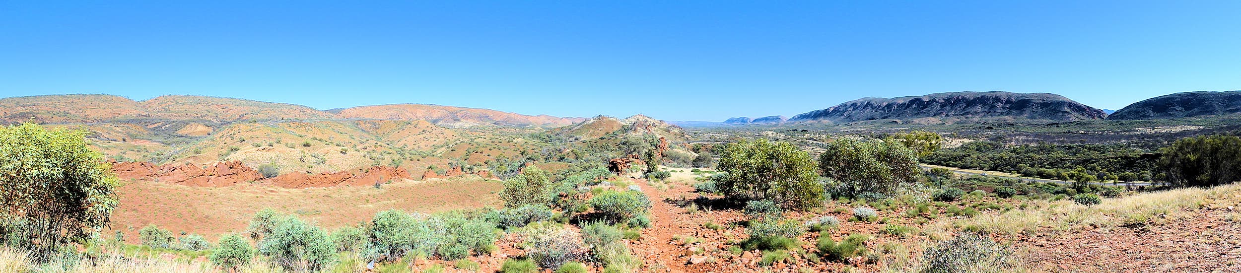
The West MacDonnell Range, known locally as the ‘West Macs’, extends west of Alice Springs over 160 km. This vast, ancient and spectacular section of the MacDonnell Ranges, encompasses the West MacDonnell National Park, and is an important refuges for plants and animals, many of which are found only here, living side by side with relics descended from ancient tropical forests.
Explore the wonders of the region, featuring landscaped that is significant in the stories of the Arrernte Aboriginal culture, a culture that existed in the region for many thousands of year.

What to see
Departing from Alice Springs, many of the main features are accessible via the sealed roads of Larapinta Drive and Namatjira Drive, which runs west along the valley.
The first port of call is Flynn’s Grave, then Simpsons Gap, where a early or late afternoon walk to the waterhole provide opportunities to see the local wallabies.
If you are coming from Watarrka National Park (Kings Canyon) access is via the unsealed road of the Mereenie Loop Road (part of the Red Centre Way tourism route – permit is required).
When to Visit and Access
The region is accessible all year round, with the cooler months being from April to September. During heavy rain the roads can become impassable for short periods. From Alice Springs, vehicle access is via Larapinta Drive and Namatjira Drive. From Watarrka National Park (Kings Canyon) access to the West MacDonnell National Park is via the Mereenie Loop Road. 4WD is recommended as the road is unsealed.
Simpsons Gap is also accessible via a 17 km sealed bicycle track that starts opposite Flynn’s Grave on Larapinta Drive, about 7 km from Alice Springs.
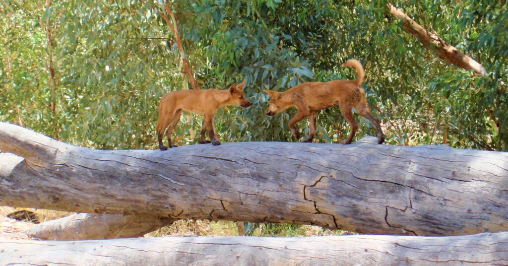
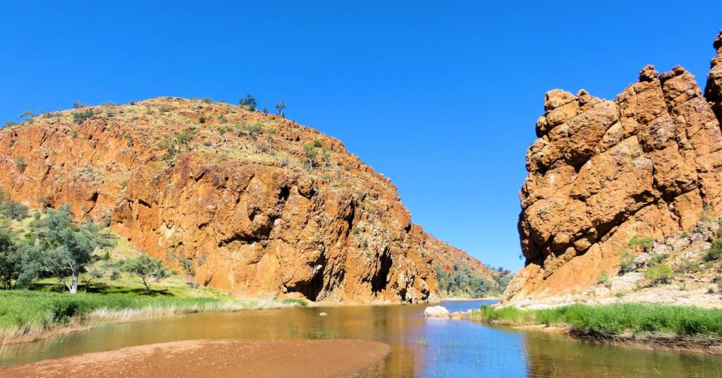
Due to its close proximity to the town centre, Simpsons Gap is popular with tourist who have limited time to explore, providing an example of a gap, which usually has some water in it, although during long periods of no rain, this can dry to a small pool of water. It is also home to the Black-footed Rock Wallaby, numerous insects and a number of species of frogs, including the Centralian Green Frog and Desert Tree Frog.
West MacDonnell Ranges
The many attractions as you travel along the West MacDonnell Ranges include the following, starting with the closest to Alice Springs being Simpsons Gap.
- Simpsons Gap
- Standley Chasm
- Namatjira Drive
- Birthday Waterhole
- Ellery Creek Big Hole
- Serpentine Reedy Hole
- The Neil Hargrave Lookout
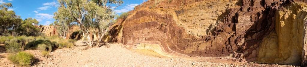
- Ochre Pits
- Ormiston Gorge
- Point Howard Lookout
- Finke Two Mile
- Glen Helen Gorge
- Mount Sonder
- Redbank Gorge
- Roma Gorge
Also located on the western side of the MacDonnell Ranges:
Images © Ausemade PL
Source: Parks and Wildlife Northern Territory – West MacDonnell National Park fact sheet.
West MacDonnell RangesBirthday Waterhole Ellery Creek Big Hole Finke Two Mile Glen Helen Gorge Jay Creek John Flynn’s Grave Historical Reserve Laura Creek Larapinta Drive Mount Sonder / Rwetyepme Namatjira Drive The Neil Hargrave Lookout Ochre Pits Ormiston Gorge & Pound Point Howard Lookout Redbank Gorge Simpsons Gap
MacDonnell RangesEast MacDonnell Ranges West MacDonnell Ranges Tjoritja West MacDonnell National Park
Northern TerritoryCentral Australia Northern Territory Fauna Northern Territory Flora Aileron Alice Springs Binns Track Chambers Pillar Historical Reserve Ernest Giles Road Finke Gorge National Park Henbury Meteorites Conservation Reserve Hermannsburg Historic Precinct Ilparpa Claypans Karlu Karlu / Devils Marbles Conservation Reserve MacDonnell Ranges Mount Connor Newhaven Wildlife Sanctuary Owen Springs Reserve Red Centre Way Drive Standley Chasm Tnorala (Gosse Bluff) Conservation Reserve Uluru-Kata Tjuta National Park Watarrka National Park & Kings Canyon Wurre / Rainbow Valley