
Rainbow Valley Conservation Reserve
Wurre Home | Fauna | Flora | Landscape
Wurre
This is an Important Meeting Place — it is an important place for family to visit and camp and to teach kids about that place and looking after country.
For the Upper Southern Arrernte People, the place you see before you is known as Wurre, a bush tucker dreaming site and an important ceremony place. Charcoal, grindstones and rock art that date back thousands of years remind us that after plentiful rain, people have always met and camped here.
When we look at the land, it’s part of us — not just a pretty sight. It’s about keeping country alive for future generations.
This arid landscape is a place of dramatic change. The pastel tones of morning give way to washed out colours of noon, which slowly change to a rich glow at sunset. Times of heavy rain bring an explosion of animal life and vivid wildflowers, then drought covers the landscape in a red blanket of silence.
Source: Traditional Owners and NT Parks and Wildlife signage
Rainbow Valley is a living cultural landscape, the traditional country of the Upper
Southern Arrernte Aboriginal people. The Traditional Owners know this place as Wurre, part of Imarnte, the country to which they belong.
Rainbow Valley Conservation Reserve is located about 75 km south of Alice Springs along the Stuart Highway. From there take the left turn onto unsealed road. A 4 wheel-drive is recommended, with the total distance being approximately 97 km.
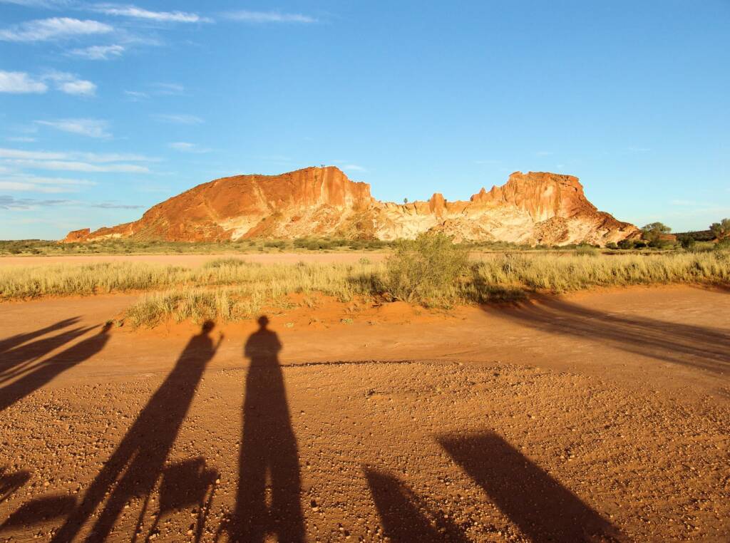
These free standing bluffs and cliffs form part of the James Range. It is a place where the dune fields meet the ranges, providing a place of stunning contrasts, with varied scenery and diversity of plants and wildlife.
Good times
During the good times, heavy rain fills the claypan, providing a stunning mirror reflecting the cliffs of Rainbow Valley. Although flooding rains is a rare event, when it happens, the desert moves into top gear. Plants spring in to frantic growth, flower and then set seed before the soil dries out again. During this time, insect, birds, reptiles and mammals go into feeding and breeding frenzy, whilst the bounty lasts.
There are some stunning photographs available of Rainbow Valley reflected in the water laden claypans. For those not so fortunate, the late afternoon and early mornings are some of the best time to view the ‘rainbow band’ colours of Rainbow Valley.
Hard times
Drought of course is the normal state of affairs here in the valley. During the hard times, desert life adapts as the conditions become drier. Many plants such as desert oaks and spinifex simply slow right down to conserve precious water. The soft grasses and herbs wither and blow away, their seeds remaining dormant in the sand for years until the right conditions return again. Many of the wildlife either move on or die off as the food shortages become critical. Others survive by slipping into hibernations as they await the next rains.
Things to do
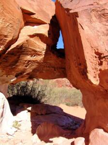
You can walk to the arch-shaped formation known as ‘Mushroom Rock’. Allow one hour for the return walk.
There are a number of other short walks in the planning stage at the time of writing.
There is a recommended cultural guided tour with the Rainbow Valley Cultural Tours. Experience the landscape with traditional Aboriginal custodian of the land, where you will learn about the cultural significance of the region and taken on a tour of the land revealing bush food and medicine, rock art (petroglyphs), artifacts, weapons, stone tools and dreamtime stories.
Access to other areas of the Reserve is by permit only.
Late afternoon in winter provides some of the best times to be in Rainbow Valley, as you can photograph it glowing in the setting sun. In summer, the sun is too far south, and the main rock face is in shadow at sunset.
Camping is permitted in designated areas only with facilities including gas, wood barbecues, picnic tables and pit toilet. It is advisable to bring in your own firewood and water.
For those who want to stay until sunset, but don’t want to drive the 99 km back to Alice Springs, Stuarts Well Roadhouse on the Stuart Highway has fuel, camp sites, motel rooms and meals. Turn left at the highway, and Stuarts Well is approximately 15 km further on. The adjoining Camel Farm also provides the opportunity for visitors to get up close with camels and also have a camel ride.
Care should be taken on all roads at night, as you may encounter a variety of wildlife including kangaroos, camels, donkeys, horses, and cows.
Be Prepared When Walking
All walkers should wear a shady hat, sun block and sensible footwear and clothing on all walks. It is essential to carry plenty of drinking water, particularly in warm weather.
Avoid strenuous activity in the heat of the day. If walking ‘off-track’ for any distance avoid walking alone and always notify a reliable person of your route and intended time of return.
Survival in a harsh land
The Rainbow Valley Conservation Reserve forms part of the traditional lands of the Southern Arrernte people. Their association with the region stretches back many, many thousands of years, as is evident from numerous sites that include evidence of rock shelters and camping places, providing evidence of grinding stones and stone tool chips. Also around the hills and ridges are numerous rock engravings or petroglyphs and rock paintings, some are faded due to exposure to the environment, but can often be seen under the right environmental conditions. The best way to view this history is through a guided tour with the descendents of the original traditional owners.
Immediately to the south of the main rock formation stands a large rock massif, known as ‘Ewerre’. This outcrop, together with the surrounding 50 m, is a registered sacred site, of deep significance to the southern Arrernte Aboriginal people. You are asked to respect their culture and beliefs and do not photograph this area or remove any rocks.
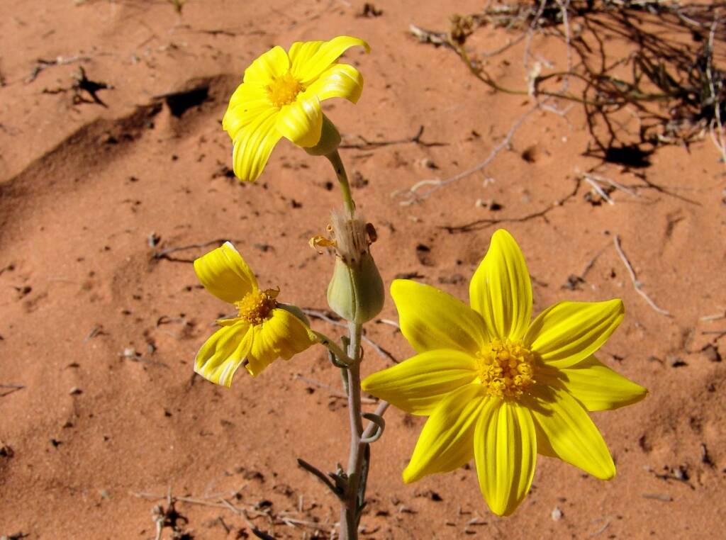
Annual Yellowtop (Senecio gregorii), Rainbow Valley 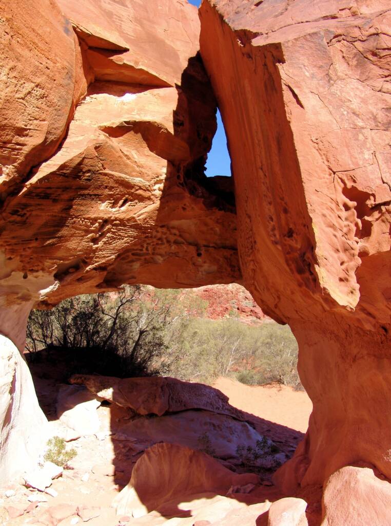
Wurre / Rainbow Valley 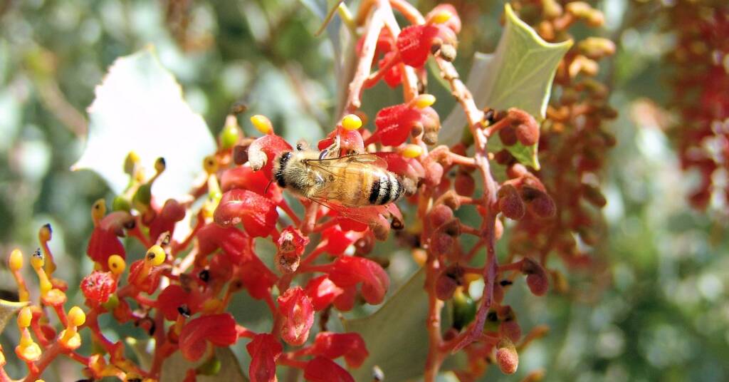
Holly Grevillea, Rainbow Valley 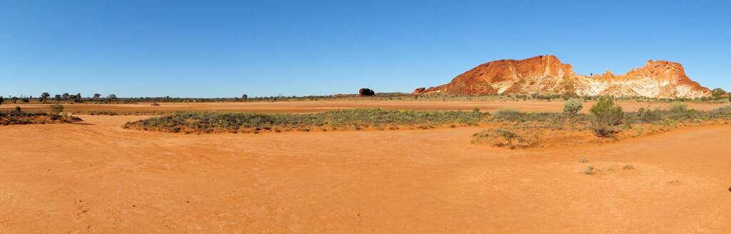
Rainbow Valley and claypans
Images © Ausemade PL